
Erosion from Laurelbook Development has destroyed life in our cove

Chronicle Chronicle Article - www.chroniclechronicle.com
Podcast.
DEQ, Army Corp and Duke Energy find Prestige and Laurelbrook Development in Violation of Erosion Control Laws
The DEQ, Army Corp of Engineers and Duke Energy have found Prestige to be in violation of erosion control laws. Efforts to hold them responsible are on-going.
Using AI we have summarized the hundreds of pages of documents into an easy to listen Podcast that you can listen to here.
2 Podcasts available
Summary of all documents
Duke Energy findings
Links to documents from the Dept of Environmental Quality are located here:
https://drive.google.com/drive/folders/1bhd8hfrO2rgMZlZGaR4eIJqL0UvUDg8R?usp=drive_link
Ver 4 is the most recent
WCNC News Coverage of Damage to Cove
Satellite Overview of Ersosion from Laurelbrook
A walk through of the destruction that can be seen from satellite imagery
Aerial Fly Over of Laurelbrook Development
How it used to be…
-
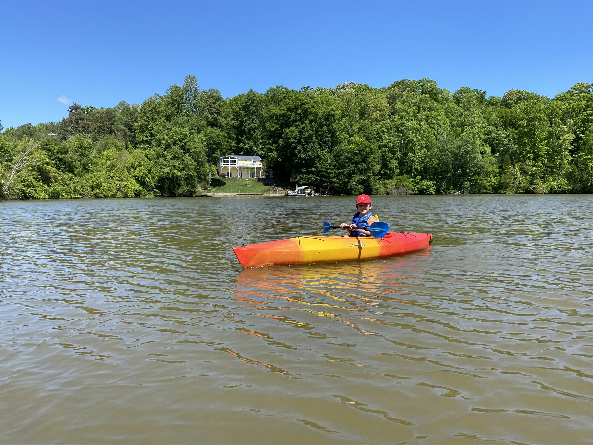
Families could enjoy it.
There was no land mass in the center of the Cove. You could boat across the entire area.
-

The water was clear for swimming.
We enjoyed clear water without worrying about debris or dirt. Our children built memories.
-
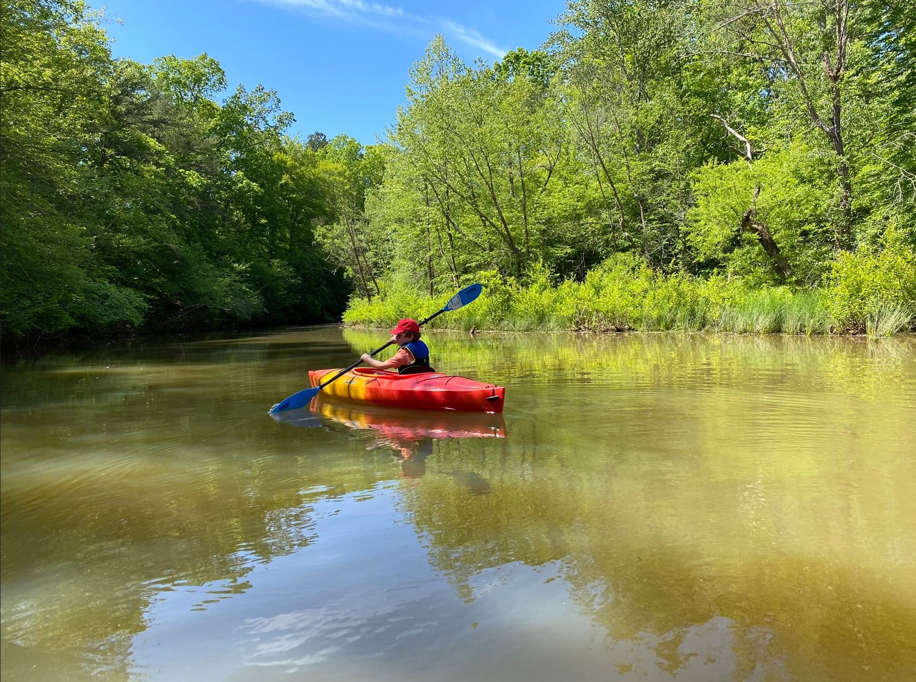
You could kayak up Terrapin Creek
We were able to kayak up Terrapin Creek including all three waterways
How it is now after damage caused by Laurelbrook development…
-

Debris continues to flow into the cove
Soil and debris continue to fill the cove day after day. Laurelbrook responds that they are “in compliance”. Whatever “in compliance” means it is not enough to stop the destruction they are causing.
-
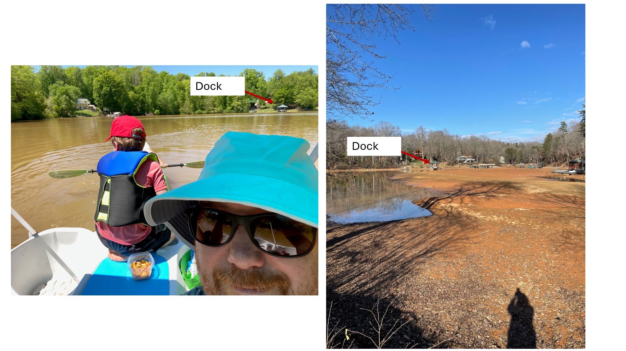
You can no longer boat in the cove
A large land mass takes up the entire cove and continues to grow. Laurelbrook development continues to do nothing and Catawba County says they are “in compliance”.
-

Prestige operates machinery in violation until they get caught
Laurelbrook Development can not be trusted to operate in a way that protects our community. They only add mitigation when they get caught and when they do they only do what is minimally required.
-

Aerial Photo Taken 2-26-2025
Recent photo of the erosion from Laurelbrook Development
-

Aerial Photo Taken 2-26-2025
No silt fences anywhere in Laurelbrook Development
-

Aerial Photo Taken 2-26-2025
No silt fences anywhere in the development.
Links to News Coverage and Documentation of Damage

Want to help? Make a donation through our Gofundme Page - Click Here to Donate
CONTACT US FOR HELP
LET US HOLD LAURELBROOK
ACCOUNTABLE
